

Introduction
Lyminge sits at the top of the Elham Valley, one of the valleys that run down the dip slope of the North Downs escarpment. This escarpment is composed of Chalk dating from the Upper Cretaceous Period, 66-101 million years ago (‘mya’).
This review outlines the topographic features around Lyminge, many of which are unique to the Chalk, as are the weathering and erosion processes that formed them. These processes are ultimately driven by tectonic forces and climatic variability. To explain these mechanisms, this discussion begins with two sections: one on tectonic uplift and the other on climatic influences.
Photographs of places where the results of geological processes can be seen are included throughout this chapter. Locations are indicated by their National Grid Reference (NGR) and their ‘what3words’’ address (///).
Physical characteristics of the Chalk
Understanding the weathering processes that have affected the Chalk over many millions of years may be aided by knowledge of its properties. Chalk is a marine sedimentary deposit. It formed under the sea from the shells (coccoliths) of minute calcareous plankton (coccolithophores) that accumulated on the seabed. This debris is almost pure calcium carbonate, a weak, water-soluble mineral.
In a temperate climate with seasonal freeze-thaw, weathering reduces chalk to gravel-sized fragments and finer particles, so when moist it has a pasty consistency. In this condition, it is susceptible to soil creep. Fig 1 shows, on the left, brecciated chalk (chalk broken into small, angular pieces held together by finer material). Weathering on the left side of the exposure has obliterated the original structure, though vestiges can still be seen on the less weathered right side. This exposure is in a slump scar on the side of the upper part of a coombe. In the context of chalk downland, “coombe” refers to the short, deep dry valleys.
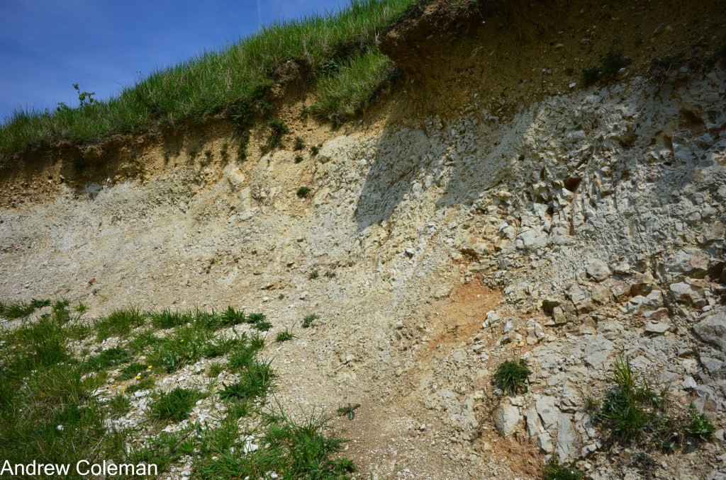
Structureless, weathered chalk like this can, if sufficiently moist, flow imperceptibly slowly downslope over slopes as gentle as a few degrees. This is a particular type of soil creep that has been instrumental in the formation of local chalk landscapes and is described below in the section on Permafrost in The particular effects of the Pleistocene climate on Chalk.
Chalk is a well-known aquifer. Water flows out of it naturally through springs and wells, or can be abstracted from man-made boreholes. An intact block of chalk is porous but not permeable. It will slowly soak up and retain water, but this water will not readily drain away. Chalk’s permeability derives from discontinuities within the Chalk mass. Primarily, these are the joints and bedding surfaces in blocky chalks, or lithological changes, for example, in the gritty chalks of the Zig Zag Chalk, which underlies much of Lyminge. In the Chalk in our area, there are two dominant joint sets: one is oriented southwest to northeast, the other northwest to southeast. Thus, they are either roughly at right angles to the escarpment, or parallel to it (Aldiss et al., 2004) (Middlemiss, 1983).
Evolution of the local landscape:
Tectonic uplift – the regional effects
The first stage in landscape formation is the uplift of flat seabed deposits, followed by deformation, creating hills and mountains (the geological term for mountain-building is orogeny). The theory of Plate Tectonics explains how parts of the Earth’s crust are uplifted to form mountain chains. The most recent mountain-building event in Eurasia was the Alpine Orogeny, which formed the mountain chains from the Pyrenees through the Alps to the Himalayas. This began about 70–80 mya during the Upper Cretaceous and is still in progress today (Jones (b), 1999)
External forces associated with that event reactivated ancient, deep-seated faults beneath what is now Kent and Sussex, faults that originated during the earlier Variscan Orogeny in the Palaeozoic Era (252-539 mya). These faults localised uplift, forming the Weald-Artois Anticline. An anticline is an upward fold of strata that forms a dome or ridge. The Weald-Artois Anticline forms an elongated dome extending from West Sussex through Kent and across the English Channel to Artois in northern France. Figs 2 and 3 show a plan and a section of the geology of south-east England.
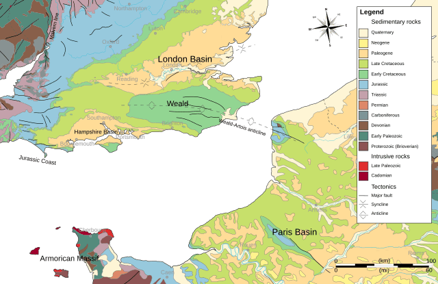
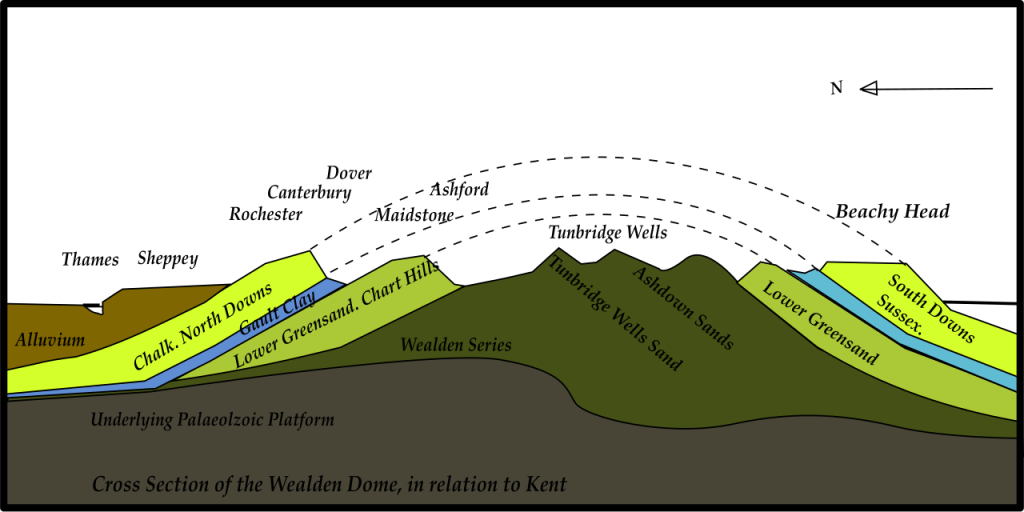
However, although weathering and erosion have removed the top of the anticline, you can get a sense of its scale if you stand on the edge of the North Downs at Farthing Common and look south-west over the Romney Marsh. You can see the core of the original anticline forming the high ground on the horizon (The High Weald). The steep slope at the southern end is the sea cliff near Fairlight, 25 miles away, and 20 miles beyond that, out of sight, lies the southern limb of the anticline: the South Downs at Beachy Head.
Most of the top of the Weald-Artois Anticline eroded between the end of the Cretaceous and the beginning of the Pleistocene, from about 66 to 2.6 mya. There is disagreement about the exact timing and rates of erosion. Many geologists now think that the erosion occurred in pulses, possibly with a major event around 23 mya, and a revival of tectonic uplift around the beginning of the Pleistocene, some 2.6 mya (Jones (b), 1999).
It is now generally accepted that erosion prior to the Pleistocene occurred in a tropical climate. (Gibbard & Lewin, 2003). This view was supported by the recognition of residual tropical soils on the top of the Downs (called Clay-with-flints). Tropical temperatures promote chemical weathering of rocks. This aggressive form of weathering still occurs in tropical and equatorial regions today. It reduces rocks to fine-grained debris – clays, silts, and sands – that form a thick weathered layer overlying a chemically etched bedrock surface. This layer can be up to 30 m thick beneath current tropical soils. Rivers resembled today’s equatorial rivers, large and meandering across a low-relief, heavily forested landscape. Although slow-flowing, they were able to remove the fine-grained weathering residue. The dense tropical forest stabilised the land between the rivers and maintained a low-relief landscape. Rates of weathering and erosion kept pace with uplift.
During this period, about 350m of Chalk was removed over the gradually uplifting Weald-Artois Anticline. If this version of events is correct, it implies that the Weald-Artois Anticline never existed as a fully formed structure; it was always subject to erosion, so the eroded anticline visible today is the most prominent it has ever been. The surviving patches of Clay-with-flints on the top of the Downs are all that remains of the once thick layer of chemically-weathered tropical soil.
The influence of the Pleistocene climate:
Regional effects on weathering and erosion
The onset of the Pleistocene glaciations (The Ice Age) about 2.6 mya marked the resumption of uplift. Temperatures dropped rapidly, and the climate became unstable, characrerised by alternating glacial and interglacial periods. This cycle was interrupted by shorter-lived stadials (colder periods) and interstadials (warmer periods).
The cycle of glacial and interglacial periods was characterised by a gradual fall in temperature leading into the glacial phase and a quicker rise in temperature at its end. These glaciations correlate with the Milankovitch cycles, which many regard as causally linked. These cycles are caused by predictable deviations in the Earth’s spin and orbit around the Sun, which affect the amount of insolation (solar energy reaching the Earth’s surface). These cyclical deviations are small, but they have the greatest relative effect at high latitudes, where the Sun is low in the sky and insolation is weak. The three cycles have lengths of about 100,000, 41,000 and 21,000 years.
Up to about 900,000 years ago, the duration of glaciations followed the 41,000-year Milankovitch Cycle. Since then, the duration of glacial cycles has increased to follow the 100,000-year Milankovitch Cycle, and the magnitude of temperature change in each cycle has also increased. The cycle now comprises an 80,000-year glacial period and a 20,000-year interglacial period, although the duration and existence of the current interglacial are both debated.(Rose, 2010)
The new, lower temperatures at the start of the Pleistocene were below the threshold needed to sustain chemical weathering, which was replaced by mechanical weathering, primarily the freeze-thaw action of ice. This is the type of weathering we know today in our Cool Temperate Climate. It does not break down rocks to the same extent or depth as chemical weathering, and it produces much coarser debris, such as sands, gravels and cobbles.
Erosion during the Pleistocene was facilitated by vigorous meltwater rivers that incised deep river valleys. Away from the valleys, erosion was less pronounced and largely confined to intermittent mass movement (rockfalls and landslides). Erosion between the main valleys could no longer keep pace with uplift, resulting in more pronounced relief typical of temperate climates. Gibbard and Lewin (op cit) considered that ‘climate, and not tectonic uplift, is the primary driver of fluvial incision in the Pleistocene’. The weight of the Pleistocene ice sheet in the north also contributed to uplift in the southern part of the British Isles; the continental crust to the north sank under the ice sheet’s weight, whilst the southern part rose in a see-saw effect.
Local features caused by Pleistocene uplift:
The effect of uplift on valleys.
As the Pleistocene uplift began, the Weald-Artois anticline became a defining feature of the local landscape. A northeast-southwest drainage pattern developed on each side of the anticline. The streams flowed at right angles to the strata, but they were able to cut through the weak clays and sands, and even through the harder Chalk by following weaknesses created by faults and joint sets that cut across the layers of Chalk.
Eventually, as the North Downs escarpment developed, it became a significant barrier. A few larger rivers were sufficiently well established to continue cutting through it; the Great Stour is the local example. The Medway and Darent are others in Kent. Many streams were not vigorous enough to keep pace with the rate of uplift, so the riverbeds were raised above the water table at the escarpment crest, causing their streams to run dry at newly developing watersheds.
Before the escarpment became a prominent feature, two streams originally flowed through it into the Elham Valley near the current locations of Etchinghill and Postling. Each followed a geological fault (shown on the Geological Map). The Etchinghill and Postling cols (gaps in the escarpment) are the remains of the original valleys, now left, quite literally, high and dry. Fig 4 shows where the flow of the upper Elham Valley stream was reversed.
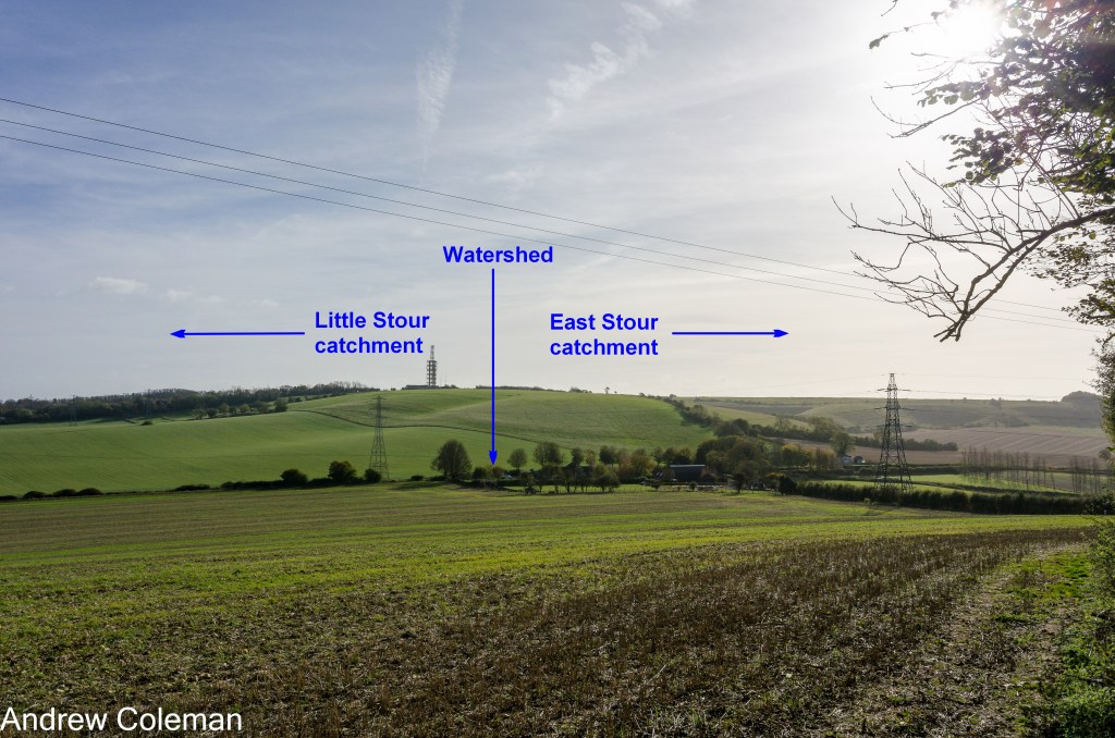
Most of the streams that the rising escarpment now forced to flow southward entered the developing East Stour catchment, feeding into the Great Stour. The streams further east flowed directly into the English Channel.
Generally, a valley’s width decreases as you move upstream. The widening at the top of the Elham Valley is therefore unusual. It is the remnant of the original confluence of the two valleys, formed by the two rivers that once flowed north through the escarpment.
There is another anomaly near the head of the valley. This is the shallow, dry valley that runs down from the west and enters the Postling Gap at Staple Farm, referred to here as the Staple Farm Valley (Fig. 5). It runs parallel to the escarpment and close to its edge for about a kilometre. This is unusual because a stream would normally flow down the nearest slope, in this case southwards down the escarpment.
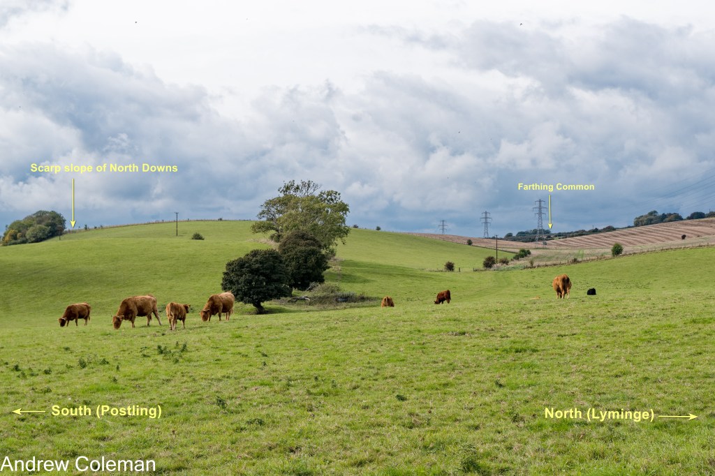
Its shape may offer clues to its history. It is shallow, with gently sloping sides, typical of a conventional river valley. The geological maps show Alluvial Clay along its bottom, indicating that the Geological Survey attributes a fluvial origin to this valley.
Most of the dry valleys close to the escarpment are typical coombes, formed by weathering and erosion of Chalk in an Ice Age climate. The geological maps show Head accumulated along the bottoms of these valleys. Head is the generic term for predominantly fine material which has moved down slope; in this context, it is a product of soil creep in a glacial environment.
The most likely explanation for the alignment and shape of the Staple Farm Valley is that it predates the significant uplift of the North Downs escarpment. The reason the stream didn’t run down the scarp slope is that the scarp slope did not then exist, or at least was not the dominant slope at that time.
This stream would have been among the first to run dry during uplift because it lay near the top of the escarpment. It would originally have flowed north into the Elham Valley, but as the new watershed developed at Staple Farm, it reversed its flow to follow the developing scarp slope to the south. The current topography shows this southward turn towards Postling, as does the mapped distribution of Head, an indicator of low ground.
The existence of a pre-uplift river valley is evidence for a recent origin of the North Downs escarpment, which was once thought to predate the Pleistocene. This can be deduced by reading the landscape alone, without recourse to geological investigations; this is a good example of geomorphology supporting geology.
The particular effects of the Pleistocene climate on Chalk:
Meltwater Torrents
During the Ice Age, proximity to the ice sheet (the closest glaciation being approximately north-west of a line between the Severn and Humber estuaries) subjected the Chalk outcrop to a Tundra Climate. Permafrost extended to considerable depth, some 20–50 m below the surface. This was interrupted by seasonal surface thaws or longer-term thaws, depending on the stage of the glacial cycle. Frequent freezing and thawing reduced the intact Chalk to silt, sand and fine gravel-sized debris.
The Victorian geologist, Clement Reid noted that permafrost would render the normally permeable Chalk impermeable, so that any meltwater would flow over it rather than soak into it (Reid, 1887). He also recognised the Chalk’s susceptibility to disintegration by freeze-thaw weathering, which made it more easily eroded by these meltwater flows. These two properties of frozen Chalk, its impermeability and its fragility, led Reid to suggest that ‘violent and transitory mountain torrents… would tear up a layer of rubble previously loosened by frost’ and that this explained how deep, steep-sided valleys could be eroded in normally permeable Chalk.
‘Violent and transitory mountain torrents’ might help explain the large size of the Elham Valley and similar valleys, despite their unusually small streams. However, the steep head slopes – common in these dry valleys – are difficult to attribute solely to torrential flows. This raises two questions: where did the abundant water supply, high above the valleys, come from? And where are the steep ravines at the heads of these valleys, which such flows would typically create?
Permafrost
The susceptibility of Chalk to degrade into fine-grained soil capable of initiating soil creep downslope was noted above in the section on the physical characteristics of the Chalk. This section briefly explains this soil creep mechanism.
In a glacial environment, soil creep can be produced by two closely-related mechanisms, solifluction and gelifluction, which differ in one crucial respect. A soil mass moving by solifluction continues to move until its initial charge of soil moisture drains away. The term gelifluction is restricted to soil on seasonally thawing ground. In this type of movement, thawing ice within the moving soil and the ground beneath it replenishes the mobilising water. This replenishment keeps the soil moving longer and farther than soil mobilised by solifluction, which relies on its initial charge of water. The soil moisture content is critical. If the soil becomes too wet, it becomes a mudflow.
Osborne White has suggested that the flat-bottomed, south-facing coombes in the dip slope of the South Downs above Brighton were formed by chalk ‘sloughing off in a pasty condition’, and that this process affected the head slopes as much as the side slopes. He was describing gelifluction. The key point is that this can explain the steep head slopes, which are otherwise difficult to account for by fluvial erosion.
In a study of soil creep at the Devil’s Kneading Trough, a scarp slope coombe above Brook near Wye, Kerney et al (1964) found that sediments originating from the coombe had been deposited in front of it as a thin lobe extending up to 1.6 km beyond the coombe (Fig 6). They conservatively estimated that the lobe’s volume was about one third of the current volume of the coombe.
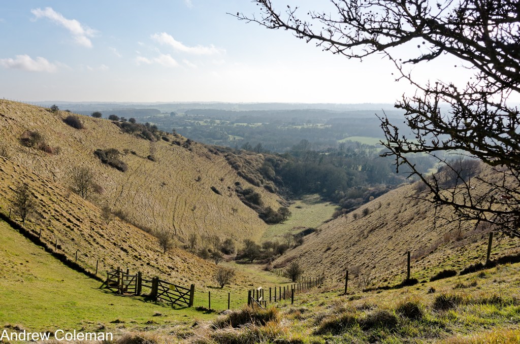
They were able to date the sediments in this lobe and found that most were deposited during a 500-year period between 8,800 and 8,300 BCE (later radiocarbon dating revised the earlier date to 9,700 BCE). The flora and fauna within the lobe indicated a prolonged humid climate, with temperatures hovering around freezing. These conditions were ideal for the initiation of gelifluction.
The long distances over which gelifluction can occur, together with the rapid rate of erosion under optimal freeze-thaw conditions, show that invoking meltwater torrents is unnecessary to explain the removal of large volumes of soil from these deep coombes. The unanswered questions posed about the source of the meltwater torrents required to form these valleys thus become irrelevant.
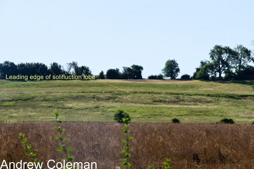
It is difficult to be certain about the origin of these coombes. This difficulty stems from the inability to observe current chalk soil creep in a permafrost environment – there is no chalk in the tundra today. Fig. 7 shows the closest local analogue to gelifluction in our climate. This is a solifluction lobe, probably affecting Clay-with-flints capping a slope above Elham. (Solifluction occurs without ice). It is occasionally active in wet winters, as demonstrated by the freshly ruptured topsoil (the flint content severely restricts flow in this example).
Local features attributed to Permafrost:
Scarp slope coombes
Fig 8 shows a westward view beyond the head of the Staple Farm Valley, revealing a later stage in that valley’s development. This location is most easily reached by following the North Downs Way footpath eastwards from the Farthing Common car park.
Note that in Fig 8 the marked difference in the colour of the grass between the base and the sides of this valley is only apparent in early spring. This arises from differences in drainage affecting the vegetation: the sides are underlain by Chalk and the base by Head.
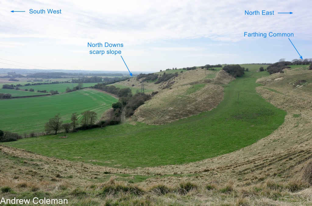
This is a scarp slope coombe typical of those found along the North Downs escarpment. It is short, with steep sides and a flat bottom, although it lacks the typical steep head slope. It initially follows the alignment of the Staple Farm Valley, parallel to the escarpment, but then turns abruptly through a right angle to reach lower ground by the shortest route, down the scarp slope.
This scarp slope coombe is a very good example of one formed primarily by gelifluction. The slow ground flow has retained its flat surface and has not been modified by subsequent stream flow, which often occurs and produces a slight “V”-shaped face to the head slope.
The well-studied Devil’s Kneading Trough coombe, only 5 miles to the west, will have been influenced by the same climatic conditions, so the same weathering processes identified there (permafrost and gelifluction) will have operated in this coombe at the same times, which helps reconstruct its history.
A likely sequence of its formation begins with the stream’s original headwaters in the Staple Farm Valley intercepting one of the southwest–northeast joint sets (or possibly an unmapped fault). As uplift made the scarp more prominent, water flow was diverted down the new scarp slope. Later, when freeze-thaw conditions prevailed and gelifluction became the dominant erosional agent, erosion continued along the new alignment established by the diverted headwaters.
This abrupt change in the direction of a coombe is also seen in one on the east side of Tolsford Hill (Fig 9), which appears to follow the line of two intersecting faults shown on the geological map. This example at Tolsford Hill also has a slight V-shaped form, suggesting fluvial erosion during the final post-glacial stages. This coombe is typical of most scarp-slope coombes, which often exhibit a hybrid form with elements of both fluvial erosion and gelifluction/solifluction.
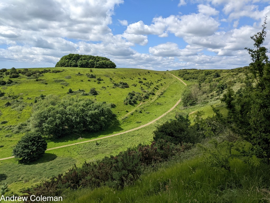
Another local example of a hybrid form is the coombe below Shearins Farm (Fig 10) on the North Downs Way east of Etchinghill. The steep sides, headwall, and flat bottom are indicative of soil creep (likely to be gelifluction), whereas the end wall shows a V-form indicative of fluvial erosion. In this case, the flat coombe bottom suggests that gelifluction or solifluction was the final erosional agent.
Cirques
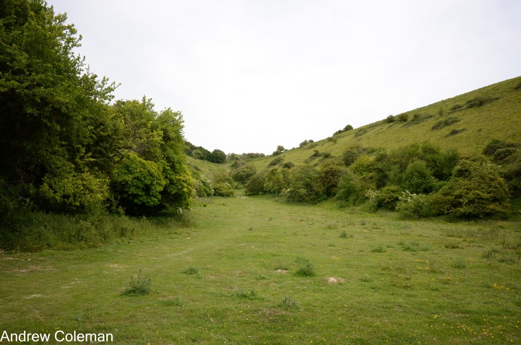
Cirques (also known as Corries in Scotland and Cwms in Wales) are concave hollows on upper, usually north-facing, slopes. They probably date to the final stages of the Ice Age, as shown by the investigation at the nearby Devil’s Kneading Trough.
A cirque forms from accumulated snow or ice that persists for much of the year, sheltered from the sun by its northerly aspect. When the snow or ice thaws in summer, water flows out from beneath the frozen mass. In the local environment, it took with it the underlying chalk, dissolved in the water or held in suspension. Over time, a concave hollow forms, which is eventually revealed as a cirque. This process is known as Nivation. Cirques are more common in mountainous areas, where they can form large curved theatre-like structures. There are examples of small cirques in the north facing slope to the west of Tolsford Hill. These can easily be seen from the Postling Road (Fig. 11).
Asymmetrical valleys
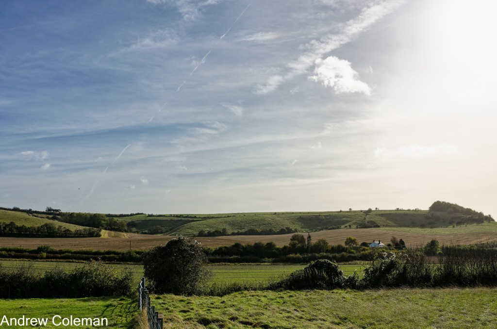
Many east-west-oriented valleys exhibit slope asymmetry, with northerly-facing slopes steeper than southerly-facing ones. This is another example of the effect of nivation. In this case, the entire northward-facing side of a valley retains snow or ice, allowing greater erosion that steepens the slope on that side of the valley. The Skeete Valley, west of Lyminge, is a good example of slope asymmetry (Fig 12). The Loughborough Lane Valley to the south is another example.
Springs and streams
To recap, springs arise from the base of a permeable, water-bearing rock (the aquifer) where it overlies a less permeable rock (the aquiclude). Groundwater accumulates within the aquifer, above the aquiclude, to a volume that depends on the aquifer’s permeability, which in turn determines its rate of depletion. The top surface of this body of water is the water table – it is not flat but curves downward towards the edge of the aquifer, where springs emerge. A stream will flow in the bottom of a valley when the stream bed intersects the water table.
Two aquicludes are present in our local area. The most productive, in terms of the number of springs it generates, is the Grey Chalk near the junction of the West Melbury Marly Chalk and the overlying Zig Zag Chalk. The springs at St Eadburg’s Well by Well Road, the one below Rectory Lane by Springside Lane, and the Eastbrook spring below Ivy Close in Etchinghill all issue close to this boundary. The seasonal stream (a nailbourne) flowing north from Broadstreet to the Eastbrook also rises from such a spring.
The other aquiclude, regarded as the main aquiclude regionally, is the Gault at the base of the Chalk. Local examples include the springs at Postling (in a private garden) that feed into the East Stour, and the springs issuing from the base of the escarpment immediately east of Etchinghill, which feed into the Seabrook Stream. Seasonal springs also occur along the Beachborough road and on the Postling road north of its junction with the A20 road.
A characteristic of Chalk that affects spring flow is its relative softness and solubility, together with its permeable discontinuities. Once groundwater establishes a flow path along discontinuities, erosion and dissolution enlarge them, further increasing flow (the same process that occurs in limestone caves, but on a smaller scale). This behaviour is used to advantage in water abstraction wells; as a well is initially developed, its yield increases over the first few months until it reaches a maximum.
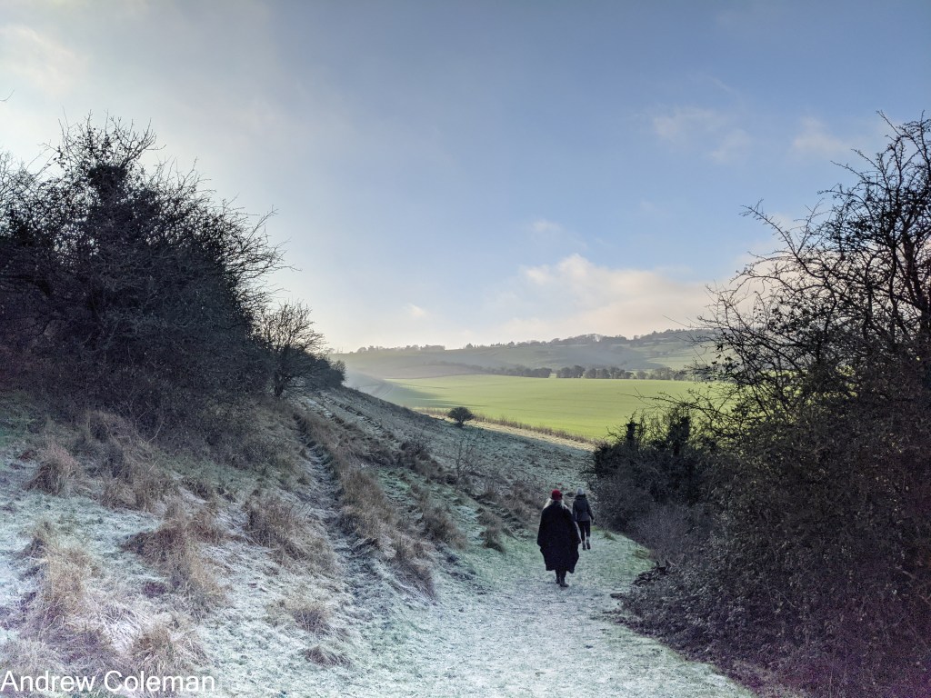
The establishment of flow paths gives springs a degree of permanence. If they appear at an inconvenient location, for example, by penetrating an aquiclude during ground works, it is difficult to cap them. The aquifer’s large size in the North Downs means springs rarely cease to flow. Springs issuing from the foot of slopes can erode back into the slope, steepening it through a process called spring sapping. St Eadburg’s Well is a good example, although cut and fill road construction has exaggerated the slope (Fig 13). Similarly, spring sapping by springs feeding into the Seabrook Stream has probably contributed to the localised steep slopes at the foot of the scarp east of Etchinghill.
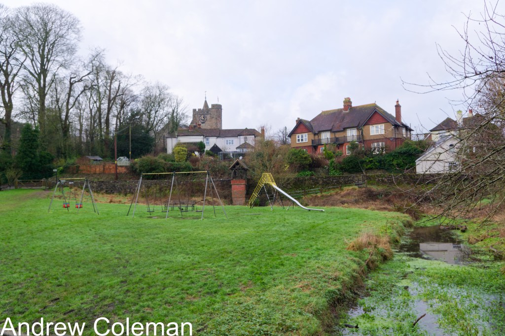
A distinctive feature of the roads around Lyminge is the frequent emergence of springs from the road verges in winter. In urban areas, groundwater can seep into the permeable backfill around utilities, not just drainage pipes, or into the granular sub-base of roads. These act similarly to French Drains—a basic land drainage system comprising gravel-filled trenches, designed to collect and redirect groundwater. When this occurs, water can break through weak spots in the road surface as road springs. Sometimes, during periods of high groundwater, water flows out of manhole covers. This may happen when groundwater in the granular bedding around pipes enters through pipe discontinuities, causing flows to exceed the pipes’ discharge capacity. A way to keep an eye on the water-table height, if you are interested in such things, is to observe the upslope progression of the highest spring eruption as winter progresses.
The Elham Valley stream is a nailbourne, an old, primarily Kentish term for an intermittently flowing stream. It is also called the Nailbourne (the Ordnance Survey has called it Nail Bourne since the 1906 edition. Nailbournes run intermittently in both time and space; they dry up in summer when the water table falls, but may also disappear underground for parts of their course, independent of changes in the water table level. This disappearance results from changes in the level of the valley floor relative to the aquifer and from variations in the lithology of the Chalk that affect its permeability. The Nailbourne disappears intermittently downstream from Ottinge, but is usually permanent downstream from Bridge.
Summary
The familiar rolling hills and steep, dry valleys of the local landscape are geologically very young. Much of their formation dates to the later part of the Ice Age, within the last 900,000 years. To illustrate this, it may be helpful to represent one million years of geological time as a single year. The oldest rocks so far found (the Nuvvuagittuq Greenstone Belt at Hudson Bay, Canada) could be about 4,300 million years old. Taking each million years as a single year, this would be about 2,300 BCE. Conveniently, this is roughly the date that the large sarsen stones were erected at Stonehenge to create the iconic circle we know today, and arguably the farthest back in time we can comfortably conceive.
On this compressed timescale, the last glaciation began only forty days ago and ended just a few days ago. From this perspective, it is easier to understand why topography formed so recently has changed so little since. In this relatively short time, only the vegetation has changed in response to the changing climate.
The primary driver of erosion in the local tundra climate was the freezing and thawing of the surface permafrost. This was facilitated by the variable climate during this period, which allowed thawing of permafrost during the frequent warming phases, and, most recently, during the last ice melt, by temperatures hovering around the freezing point.
Repeated freezing and thawing of the Chalk reduced it to a fine-grained soil, an ideal medium for mobilisation by gelifluction. This removed significant volumes of Chalk relatively quickly during thaws, resulting in the characteristic coombes seen near the crest of the escarpment.
Tectonic movement played a part by uplifting the anticline and associated escarpments, but some of this uplift also resulted from isostatic adjustments in response to the additional weight of the northern ice cap, itself a consequence of the Ice Age climate. Uplift, which continues today, has raised the river valleys above the water table, resulting in dry valleys.
Uplift dramatically altered stream courses, reversing flow over the escarpment crest. Sizeable rivers, if not meltwater floods, were the principal agents of erosion in the Elham Valley until the uplift of cols at Etchinghill and Postling cut off the water supply from the higher ground to the south.
The Principle of Uniformity, proposed by James Hutton (1726-97) held that the processes that formed ancient rocks could be understood by observing the same processes operating in comparable rocks today (Hutton 1788). Charles Lyell (1797-1875) popularised this idea by coining the phrase: ‘the present is the key to the past’. (Lyell, 1833). Accordingly, the idea that all the dry valleys in Chalk, including the coombes, originated from Ice Age meltwater floods was widely held throughout most of the twentieth century. In the absence of any other agent capable of rapidly moving such large volumes of soil, it was assumed, on the basis of contemporary experience and reasoning, that torrential floods were responsible.
The difficulty with applying Hutton’s principle to a Chalk landscape is that there is now nowhere where chalk exists in a Tundra environment. No place demonstrates how Chalk erodes in such a climate. It therefore requires some interpretation to determine what erosional processes could have occurred in the North Downs, under conditions that are completely alien to us today. In the words of Clement Reid, when referring to the rolling outline of the hills and steep valleys of Chalk downland, ‘but perhaps because so familiar, it does not at first strike one that these outlines point to conditions which have now entirely passed away.’
Andrew Coleman
Rev. 16/11/2026.

