

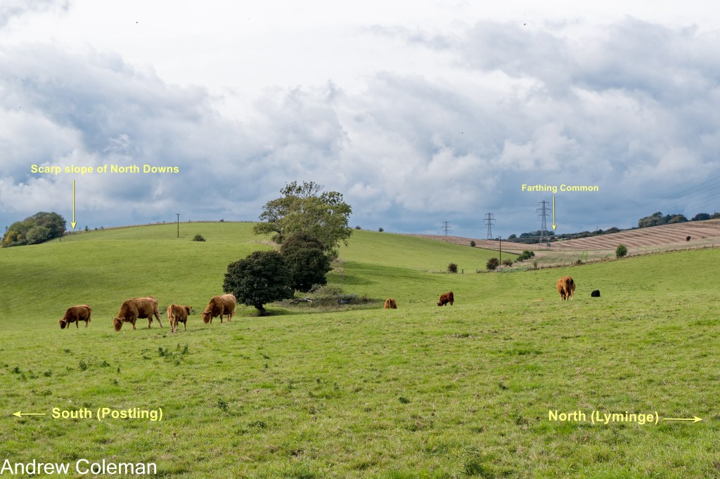
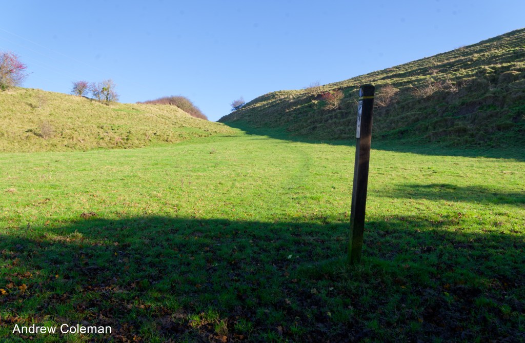
There is a dip-slope dry valley in the North Downs, above Postling, referred to here as the “Staple Farm Valley” (Photo 1). It runs parallel to and close to the escarpment edge for about 1 km, rather than taking the shortest route down the scarp slope. A valley with this alignment near an escarpment suggests an unusual origin.
British Geological Survey digital maps, Geoindex and the BGS Geology Viewer (viewed 2026) show Alluvium along the bottom of this valley. The printed map, published in 1966 (re-print 1990), also shows Alluvium on the valley floor, indicating that the Geological Survey attributes a fluvial origin to this valley. This is unusual as most dry valleys near the North Downs escarpment are mapped showing Head on the valley floor, which, in these locations, is a deposit derived from periglacial mass movement (gelifluction or solifluction), as noted by Osborne White (1924) and Kerney et al. (1964).
(It is worth noting that the Survey appears to use the terms Head and Alluvium arbitrarily – see the abrupt (unnatural) mapped boundary between the two deposits at the lower end of this valley).
Valleys close to the escarpment typically show a coombe profile – deep, steep-sided, with flat bottoms formed by periglacial mass movement. The Staple Farm Valley profile is shallow, with gently sloping sides, typical of fluvial valleys. A post-glacial fluvial phase at this high elevation above the water table is most unlikely, this would suggest an origin that predates the period when periglacial mass movement was dominant.
One explanation for the origin of this shallow valley is outlined in “Some origins of Chalk Downland landscape”, section 2.2, “The effects of uplift on drainage in south east Kent.” That section describes how early rivers flowed down the northern side of the developing Weald-Artois anticline and, locally, across what was to become the North Downs escarpment before it had risen sufficiently to present an obstacle (Jones (b), 1999; Murton J. B. & Giles D. P., 2016). Some kept pace with uplift and continued to flow northward, eroding through the rising escarpment; the Stour and Medway rivers are local examples. Other rivers failed to keep pace with uplift, and their valleys were raised above the water table, leaving dry cols in the escarpment. The Postling and Etchinghill cols are local examples.
In this scenario, the original Staple Farm stream would have been an early tributary feeding a river flowing north from the Weald-Artois anticline along the current Elham Valley (a headwater of the “Little Stour”). Uplift of the escarpment caused the upper part of this river, south of the escarpment, to reverse its flow southwards from the col, becoming a headwater of the East Stour. Initially, the Staple Farm stream continued to flow, turning south to follow the East Stour, as evidenced by the bend at the lower end of the valley (Photo 1) and by the distribution of Alluvium on the geological map. These valleys are now dry.
If the proposed chronology of the Staple Farm Valley is correct, it provides supporting geomorphological evidence for late Pleistocene uplift of the North Downs. The valley runs parallel to the scarp slope rather than down it because the scarp slope was not a prominent feature when the valley was forming.
The Geological Survey Memoir for Canterbury and Folkestone (Smart et al., 1966) presents an earlier alternative explanation for the origin of the shallow valley.
It suggests that the Staple Farm Valley was formed by an eastward-flowing headwater of the Little Stour (now called The Nailbourne). Another stream, arising from a spring to the south of Staple Farm at the foot of the escarpment, fed into the East Stour catchment. This spring cut back northwards into the scarp slope by a process called spring sapping. It eventually intercepted the headwater of the Little Stour and diverted it southwards, cutting off a headwater of the Little Stour. (Follow this link to Examples of stream capture?)
This explanation assumes that the escarpment already existed. It does not address the oddity of a river flowing parallel to a slope rather than down it, but it does explain a right-angled bend at the bottom of the Staple Farm Valley.
There is a short scarp-slope coombe immediately beyond the head of the Staple Farm Valley (Potos 2, 3 and 4). This coombe initially follows the alignment of the Staple Farm Valley but then turns abruptly by about 90 degrees to run down the adjacent scarp slope. It has the typical coombe profile. The floor of the coombe merges uniformly into the head slope and does not show the “V” shape present in many coombes, which, when present, suggests a brief fluvial stage at the final stage of their formation.
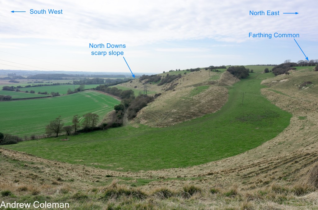
N.B. The contrasting vegetation colour is only apparent in early spring, reflecting the differing drainage characteristics of the underlying soil.
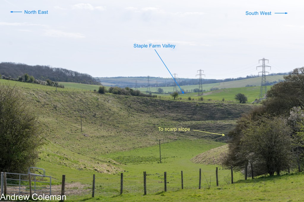
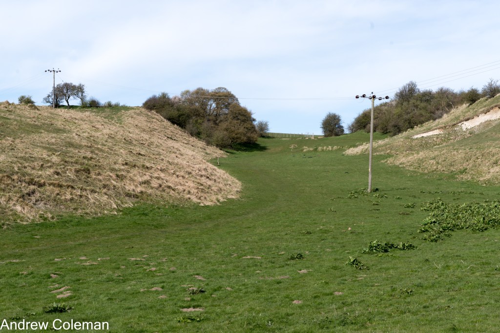
Given its proximity to the well-researched Devil’s Kneading Trough, about 8 km to the west (Some origins of Chalk Downland, Section 4.3), this coombe is likely to share a similar history, i.e., it is a recent feature, with much of it formed at the end of the last glaciation and during ice melt between about 10,900 BCE and 9,700 BCE (Whiteman & Haggart, 2018, dates revised from Kerney et al., 1964). This would post-date the formation of the Staple Farm Valley.
The British Geological Survey digital maps (BGS Geoindex, BGS Geology Viewer) and the printed map, published in 1966 (re-print 1990), all show the base of this valley to be underlain by “Head” – a deposit derived from mass movement caused by the thawing of permafrost chalk. Photo 5 shows brecciated and weathered, probably in-situ, chalk exposed in a slump scar on the side of the upper part of the coombe.
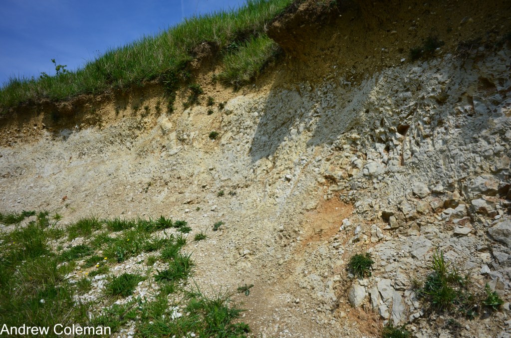
Photo 5
It seems likely that the alignment of the scarp slope coombe is affected not only by proximity to the slope but also by the structure of the Chalk. It is a well-known feature of water flow in chalk that pathways preferentially develop along existing discontinuities (mainly joints and faults), which become more permeable as water flow continues along them. (This characteristic is used by water engineers to “develop” water wells in chalk).
There is a coombe on the south slope of Tolsford Hill that also changes direction through 90° (Photo 1, Royal Saxon Way, Tolsford Hill). This coombe partially follows the alignment of a fault shown on the BGS Geoindex map, trending approximately north-west to south-east. No faults are mapped in the coombe near Postling, but the chalk is blocky (the Zig-Zag Chalk Formation) and typically jointed. Middlemiss (1983) reported two major joint sets near Dover, one orientated at 300° and another at 205°–210°, which would be roughly parallel to and at right angles to the scarp slope.
The abrupt right-angled turn in the coombe may have been initiated by an early stream that intersected one of the north-east to south-west joint sets (or an unmapped fault), diverting the stream down the developing scarp slope. Subsequent periglacial mass movement then followed the course the stream had set.
The gully shown in Photo 6 exhibits a hybrid form. Its “V” shape suggests that fluvial erosion was a factor in its formation, but the fan-like deposit in front of the coombe is typical of periglacial erosion. Perhaps fluvial and mass movement erosion alternated with glacial and interglacial conditions.
In summary, the Coombe near Postling and the shallow valley next to it are likely to have formed by different processes at different times. Confirmation of the nature and age of the sediments at the base of both valleys would go a long way to resolving uncertainty surrounding their histories. Perhaps it is pertinent to note that Whiteman & Haggart (2018), in their review, remark that, given the length of time involved (from the late Cretaceous through to the Quaternary), it would be surprising if the origin of chalk landscape features were not the result of more than one process. These two valleys appear to demonstrate this diversity.
Andrew Coleman
10/09/2026
References:
Jones, D. (1999). On the uplift and denudation of the Weald (B. J. Smith, W. B. Whalley, & P. A. Warke, Eds.; SP 162, pp. 25–43). Geological Society Special Publications. http://sp.lyellcollection.org/
Middlemiss, F. A. (1983). Instability of Chalk cliffs between the South Foreland and Kingsdown, Kent, in relation to geological structure. Proceedings of the Geologists’ Association, 94(2), 115–122. https://doi.org/10.1016/S0016-7878(83)80003-0
Murton J. B., & Giles D. P. (2016). The Quaternary Periglaciation of Kent. Field Guide. Quaternary Research Association.
Smart, J. G. O., Bisson, G., & Worssam, B. C. (1966). Geology of the Country around Canterbury and Folkestone. Her Majesty’s Stationery Office.
Whiteman, C. A., & Haggart, B. A. (2018). Chalk Landforms of Southern England and Quaternary Landscape Development. Proceedings of the Geologists’ Association. https://doi.org/10.1016/j.pgeola.2018.05.002

