
This commentary starts on the sea front at Sandgate but the RSW starts at St Mary & St Eanswythe Church in Folkestone. Before you leave the church, see the section Building Stones in the churches of the RSW.
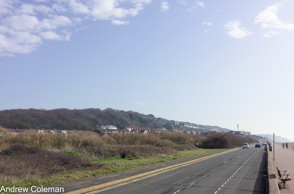
The steep slope which rises behind the sea front is the eastern end of the Greensand Ridge escarpment (Photo. 1). This is one of two parallel escarpments facing the coast in this part of Kent, the second being the North Downs.
The geological sequence in this escarpment comprises, from the top downwards:
- The Folkestone Formation.
- The Sandgate Formation.
- The Hythe Formation.
- The Atherfield Clay Formation.
As these strata are slightly tilted to the northeast, as you walk along the shore southwestwards you pass over successively older rocks from the Folkestone Formation down to the Atherfield Clay Formation. If you continued west beyond the RSW, you would eventually reach the clays and mudstones of the underlying Weald Formation.
As you make your way along the seafront to Sandgate, and if you are passing at low tide, you will see an outcrop of rocks breaking through the water. This is the Hythe Formation limestone which outcrops on the foreshore below The Grand Hotel at the western end of The Leas (Photo 2). This rock comprises alternate beds of limestone and calcareous (lime rich), often greenish coloured, sand and weak sandstone. The limestone is known locally as Ragstone and the sand or sandstone as Hassock. The layers vary from about 0.2m to 0.5m thick in east Kent.
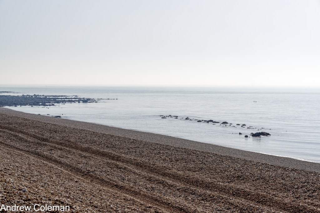
The northeast dip of the rock causes the elevation of this outcrop to rise from sea level in the east (Photo 2) to almost the top of the escarpment west of Hythe. This escarpment is extensively land-slipped, the slips extend west towards Aldington. So, if you find this rock on the foreshore west of The Leas, it is most probably land-slipped having slid seaward from its in-situ position in the slope and downwards onto the foreshore, often coming to rest at a steep angle.
A deviation: Follow this link to The Ancient Landslip for further information and a more convincing example of land-slipped rocks.
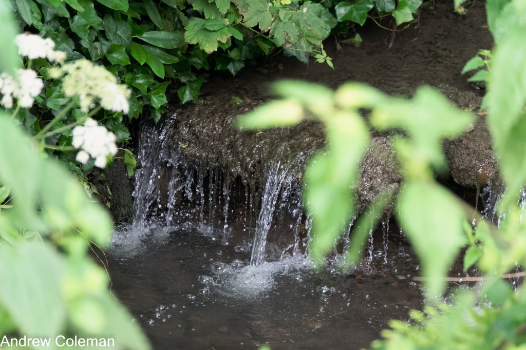
At the Castle Road Car Park in Sandgate you are standing above the oldest rocks encountered on the route, the Atherfield Clay Formation. The RSW turns inland here, and as you cross Sandgate High Street you pass up onto the overlying Hythe Formation. (The same rocks which were seen on the foreshore to the east, below Leas Cliff). The route initially follows the stream in the Enbrook Valley the bottom of which is mapped as the Hythe Formation. There are small water falls in the stream bed which look to be man-made structures, but some may be in-situ outcrops of the Hythe Formation limestone (Photo 3).
The Hythe Formation is more resistant to erosion than the deposits of sands and clays above and below it and so it usually forms a pronounced steep slope. It is frequently exposed in the “back scar” of landslips, where it forms small inland cliffs, for example above “The Roughs” to the west of Hythe (see Photo 4). Many of these back scars have been quarried, to access the exposed Ragstone.

Good quality Ragstone is more dense than concrete and has commonly been used as building stone throughout Kent. The largest quarries are further west along the outcrop, particularly on the west side of Maidstone where the limestone tends to be thicker and of higher quality. Small, abandoned quarries are common throughout its outcrop. There is historic reference to a Ragstone quarry in west Sandgate at a location referred to as “Wellington Terrace” (Topley, 1893). The topography suggests that part of the current Wellington Place has been built in this quarry (TR 1965 3504, ///putty.musically.enveloped).
As you climb up Military Road out of Sandgate you follow the steep side of the Enbrook Valley. The gently sloping playing field adjacent to Military Road is mapped by the Geological Survey as Landslide Deposits over the Sandgate Formation, which overlies the limestone of the Hythe Formation. The Sandgate Formation consists of clays, with occasional iron rich sands and weak sandstones but in its slipped state it is characterised by inclusions of black decaying vegetation which has been enveloped in the sliding mass. In some cases, large, detached rafts of apparently in-situ ground, can be found overlying decaying vegetation at depths of several metres. In those circumstances if a ground exploration was limited to shallow pits, rather than deep boreholes, it could give the erroneous impression that the ground is in-situ and stable.
The slope bordering Military Road is underlain by the Folkestone Formation which comprises coarse sands and some sandstones (See Photo 5). The top of the Folkestone Formation underlies the extensive plateau which includes St Martin’s Plain and military camps.
Continued in “St. Martin’s Plain to Etchinghill”.
Andrew Coleman
Rev. 16/02/2025
References:
Blows, J. (2011). Strategic Stone Study – A Building Stone Atlas of Kent. http://maps.bgs.ac.uk/buildingstone?County=Kent
Smart, J. G. O., Bisson, G., & Worssam, B. C. (1966). Geology of the Country around Canterbury and Folkestone. Her Majesty’s Stationery Office.
Topley, W. (1893). The landslip at Sandgate. Proceedings of the Geologists’ Association, 13(2), 40–47. https://doi.org/10.1016/S0016-7878(93)80025-7
